Skip to content

The easiest place to imagine a data center is not necessarily the easiest place to build one. A server campus needs a reliable electrical system, diverse fiber routes, suitable land, predictable permitting, construction access, and enough physical room to expand without forcing the next phase into another property search, and those requirements often point toward the same broad landscapes that humans have historically considered difficult to inhabit. Interior regions can offer large development areas and the opportunity to coordinate land, electricity, fiber, and supporting infrastructure at campus scale. Water therefore enters the location decision as a constraint rather than an automatic veto, because the question is not simply whether a region has water but whether the proposed cooling architecture can operate within the area’s hydrological limits.

Land, Fiber, Power, and Latency Can Beat Climate Comfort
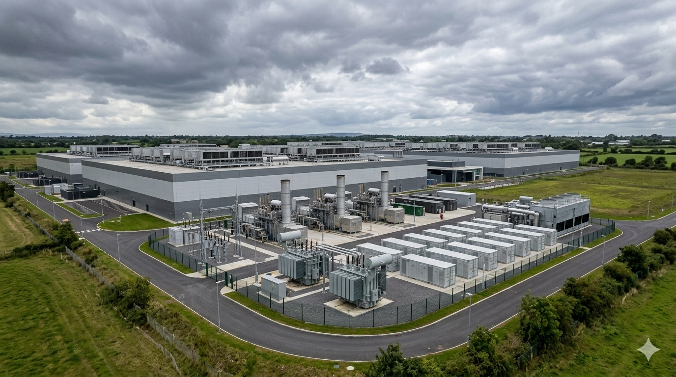
Location calculus starts with physics, but it does not stop there, because a technically attractive site must also connect to an electricity system capable of supporting continuous high-density computing and to network infrastructure that can move workloads without creating unacceptable latency or resilience risks. Land matters because large-scale campuses require room for electrical yards, cooling equipment, security setbacks, substations, construction staging, water infrastructure, and future expansion, while fiber matters because proximity to multiple network paths can influence both application performance and the commercial usefulness of a site. Power availability can become a decisive constraint because transmission and generation upgrades generally require longer planning and development cycles than securing additional land. Water then becomes part of the same interlocking system, since cooling design determines whether the site requires substantial withdrawals, recycled supplies, closed-loop systems, or little operational water for heat rejection.
The Southwest United States illustrates why this calculation remains difficult even when water risk is obvious before construction begins. Dry climates can change the cooling and heat-rejection requirements that data centers must manage, particularly when high ambient temperatures coincide with continuous computing loads. Operators can respond by changing the cooling architecture, raising allowable operating temperatures, reducing evaporative dependence, using closed-loop designs, or shifting toward liquid cooling approaches that manage heat closer to the processor, but each decision changes the site’s electrical profile, equipment requirements, maintenance model, and water exposure. The choice therefore does not reduce to an argument between water and technology because a cooling system that consumes less water can increase electricity demand, while a highly efficient evaporative approach can reduce electrical consumption while creating greater dependence on a local water system.
Arizona Isn’t Empty, It’s Already Overdrawn
Arizona’s data center story becomes clearer when the desert stops looking like empty land on a satellite image and starts looking like a working water system with competing users. Phoenix and its surrounding communities have grown around a complicated combination of municipal demand, agriculture, groundwater systems, imported river water, and infrastructure built to move and manage supplies across a naturally dry landscape, meaning that a new industrial load enters an existing network rather than an untouched resource pool. The Colorado River remains central to that story, but Arizona’s water position cannot be understood through the river alone because groundwater, local surface supplies, reclaimed water, irrigation systems, and municipal conservation policies all shape the actual availability of water at a particular site. Population growth adds another layer because homes, businesses, farms, and industrial projects compete within the same regional hydrological framework even when their individual water contracts look separate on paper.
Phoenix and Mesa Sit Inside a Larger Water System
The Phoenix metropolitan area demonstrates how data center expansion can collide with the accumulated consequences of decades of urban and agricultural development. Phoenix and Mesa offer established utility and water infrastructure alongside substantial development capacity, while Mesa maintains a diversified water portfolio and a state-recognized 100-year assured water supply designation. The Arizona Department of Water Resources tracks Colorado River conditions alongside other components of the state’s water system, underscoring why supply planning cannot rely on one reservoir or one river as a permanent source of certainty. Long-term planning also has to distinguish between physical availability and legally or operationally accessible supplies, because water can exist somewhere within a basin without being available to a particular project under the conditions that project requires.
Agriculture makes the Arizona equation even harder to simplify because farming has shaped both the physical infrastructure and political expectations surrounding water across the region. A data center does not arrive in a blank desert where its water requirements can be assessed independently, because irrigation districts, municipalities, households, industrial users, and ecological interests already depend on systems that have developed over generations. The resulting debate often focuses on whether a new project actually consumes a meaningful quantity of scarce water, whether it can use reclaimed supplies, whether its cooling system can operate without evaporative losses, and whether its economic contribution justifies the additional pressure placed on local resources. Those questions cannot be answered through a single statewide figure because water conditions differ between basins, municipalities, aquifers, and individual projects, while the engineering choices inside a data center can materially change its operational water profile.

Aragon’s Second Life as Europe’s Desert Lab
Aragón’s appeal to data-center developers becomes clearer when its available land is considered alongside the electricity, fiber, water, wastewater, and other infrastructure identified in regional development plans. Zaragoza sits within an interior landscape where land availability, energy development, road connections, fiber connectivity, and proximity to established cloud infrastructure can combine into a more useful proposition than a simple climate comparison would suggest. The region has already moved beyond the stage of being an experimental destination, with the Government of Aragón processing large-scale data center projects and expansions involving AWS and Microsoft across several municipalities. Those plans show that developers are not evaluating Zaragoza as an isolated parcel but as a connected infrastructure geography in which multiple sites, high-voltage connections, fiber routes, water systems, and existing digital infrastructure can reinforce one another.
Zaragoza Turns Interior Geography Into Infrastructure Advantage
Zaragoza’s appeal becomes more understandable when the location is examined as a systems problem rather than a search for an ideal climate. Zaragoza’s location within Aragón has supported large-scale data-center development because regional planning combines available land with electricity, fiber, water, wastewater, and other supporting infrastructure. The surrounding region also has an established renewable energy base, which has encouraged developers to pair computing infrastructure with dedicated or associated solar and wind generation rather than treating electricity procurement as a completely separate exercise. Recent projects show how far this strategy has evolved, with MERLIN’s Zaragoza-WIND development designed around a substantial degree of on-site renewable generation and a large-scale data center configuration, while other proposals have emphasized direct access to Spain’s high-capacity electricity network and alternative cooling architectures.
Aragón’s transformation also shows why depopulation can become an infrastructure variable without making the region economically irrelevant. Aragón’s relatively low population density has contributed to the availability of land for large infrastructure projects, while the region’s data-center plans also depend on the expansion of electricity and digital infrastructure. That does not mean every underpopulated area can support hyperscale computing, because electricity, fiber, water, permitting, workforce access, environmental conditions, and transmission capacity still determine whether a site works. Aragón has gained an advantage because those pieces increasingly exist together, allowing data center development to reinforce an infrastructure network that already supports digital services rather than creating an entirely new network in an isolated rural location.
Andhra’s Coastal Paradox: Humidity Does Not Mean Water
Andhra Pradesh presents a different version of the same location paradox because its coastal geography can create the visual impression of abundant water while offering no guarantee that a particular industrial site can depend on freshwater indefinitely. A coastline supplies access to the sea, but seawater does not automatically become usable cooling water, and converting it into a reliable industrial supply introduces treatment, energy, discharge, corrosion, and environmental considerations that developers must evaluate alongside conventional freshwater sources. Groundwater adds another complication because coastal aquifers can contain interfaces between fresh and saline water that respond to pumping, geological conditions, recharge patterns, and local development pressure. The Central Ground Water Board’s assessment of Andhra Pradesh identifies spatial and depth-related variation in groundwater quality and notes that intensive freshwater abstraction can cause saline water to migrate upward or inland under certain hydrogeological conditions.
Coastal Access Does Not Remove Groundwater Risk
The Andhra case becomes especially important when coastal groundwater is treated as an engineered reservoir rather than an unlimited underground utility. The Central Ground Water Board’s more recent assessment of Andhra Pradesh continues to classify groundwater units across different categories and separately identifies saline areas, showing why state-level groundwater security cannot be reduced to a single availability label. Coastal aquifers can behave differently from inland systems because pumping can alter the balance between freshwater recharge and saline water, while agricultural extraction, aquaculture, urbanization, and industrial use can add competing pressures around the same resource. The technical issue becomes even more complicated when a facility needs high-quality water because cooling systems can impose specifications that differ from ordinary municipal consumption, particularly where treatment, filtration, corrosion control, and discharge requirements become part of the thermal design.
The comparison with Chennai and Hyderabad makes the coastal paradox more useful because water security in both markets depends on the condition and reliability of their underlying water-supply systems rather than geography alone. Chennai’s coastal groundwater system has faced documented concerns over saline-water intrusion, with the Central Ground Water Board maintaining monitoring and recharge-related work focused on the problem. Groundwater assessments along the Chennai coast have documented saline-water intrusion as a specific management concern, reinforcing the need to evaluate coastal aquifers rather than treat proximity to the sea as evidence of freshwater security. Hyderabad demonstrates why an inland technology market also needs to account for groundwater conditions and the reliability of its broader water-supply system.
When a Data Center Drinks Like a Town
A large data center becomes a more tangible community issue when its water requirement is expressed in terms that residents can compare with familiar household or municipal demand. Residents do not experience cooling towers, chilled-water loops, heat rejection, or water-treatment systems as abstract engineering components, because they experience the same underlying resource through household bills, municipal restrictions, agricultural allocations, groundwater levels, and the reliability of their local supply. That makes comparisons with community consumption useful as a communication tool, but such comparisons need careful qualification because a data center’s water profile depends heavily on climate, cooling design, operating conditions, water quality, and whether the project uses potable, reclaimed, recycled, or other sources. A campus that relies heavily on evaporative cooling can have a very different water footprint from one designed around closed-loop systems or advanced liquid cooling, even when both provide similar computing capacity.
Cooling Architecture Changes the Community Conversation
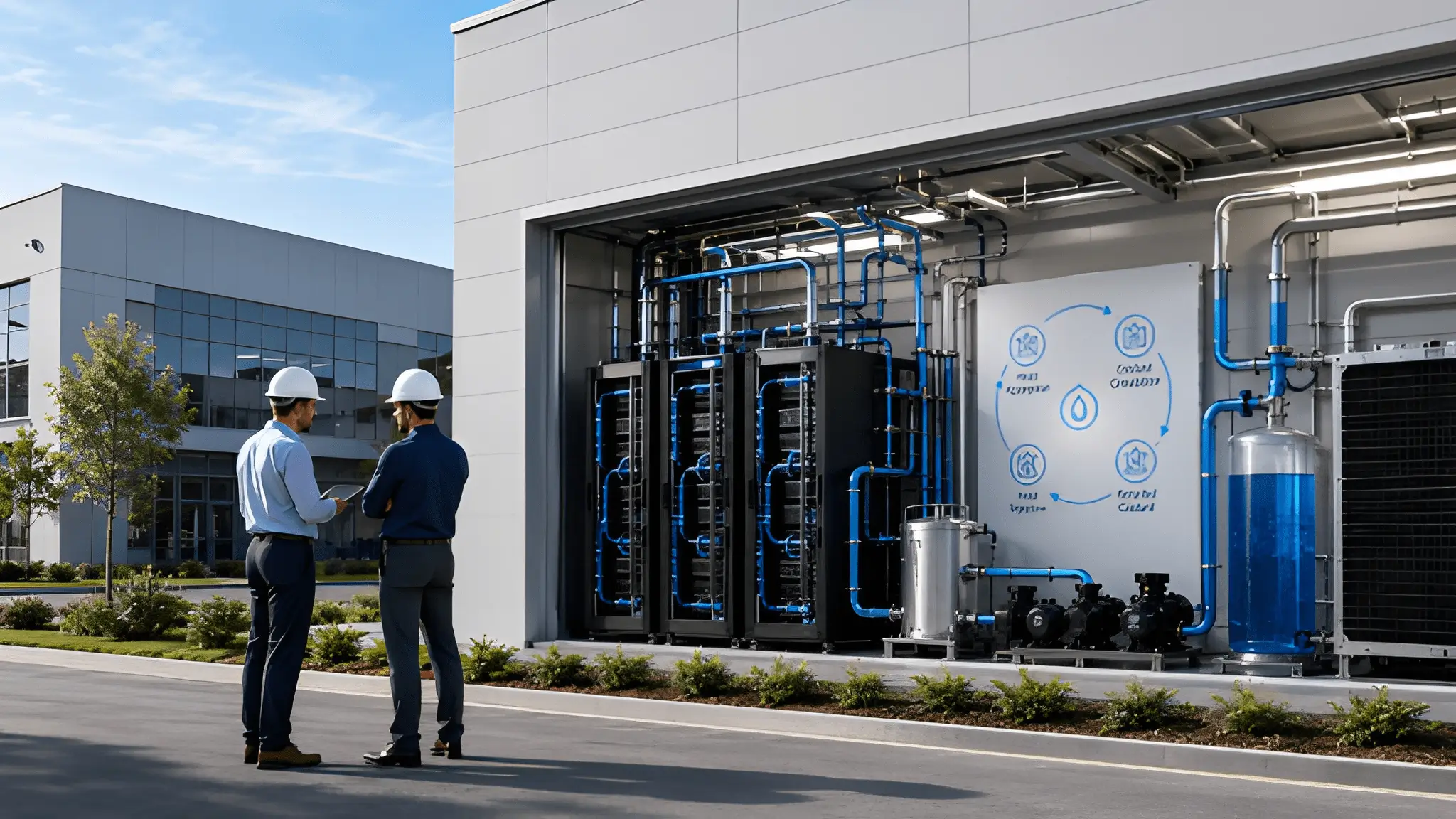
The most important technical distinction is between water withdrawal and water consumption because the two describe different impacts on a local system. A cooling system can draw water, use it within a treatment or heat-rejection process, and return some portion through a controlled discharge pathway, while another system may consume a larger share through evaporation and therefore remove that water from immediate local availability. Engineers also have several ways to alter this balance, including dry cooling, hybrid cooling, reclaimed-water systems, closed-loop arrangements, and designs that increase the allowable temperature of the heat-transfer system. Each choice carries a different combination of electrical demand, equipment cost, performance characteristics, maintenance requirements, and exposure to ambient conditions, which means water efficiency cannot be assessed separately from power efficiency.
For communities, The clearest proposals will make the project’s water source, cooling approach, treatment requirements, reuse arrangements, and drought contingencies visible before construction begins. A developer that says a campus will use less water than an alternative design provides only part of the information, because residents also need to understand where that water comes from, whether the source remains available during drought, how much returns to the system, what happens to concentrated wastewater, and whether the project changes municipal infrastructure requirements. The same principle applies to reclaimed water because reuse can reduce competition for potable supplies while creating additional treatment, pipeline, pumping, and quality-control obligations that still require energy and capital. Arizona, Aragón, and Andhra each demonstrate why these details matter, since the same cooling technology can produce different consequences depending on the water source, climate, hydrology, grid conditions, and surrounding demand.
The Water Constraint That Can Decide Location Fate
One increasingly important consideration in data-center site selection does not appear on conventional technology maps: the availability and characteristics of the local water system. A latency map shows where users sit, a fiber map shows how traffic moves, and a transmission map shows where electricity can arrive, but a hydrology map reveals whether the physical system beneath the proposed campus can continue supporting the project when weather conditions become unfavorable. That distinction matters because a data center does not consume resources only during favorable operating periods, and its cooling system must continue rejecting heat when reservoirs decline, groundwater becomes harder to access, or competing users face tighter restrictions. Water availability therefore, moves from a permitting consideration toward an early-stage location variable that can eliminate otherwise attractive sites before developers commit substantial capital to land and electrical infrastructure.
Hydrology Maps Are Becoming Infrastructure Maps
Hydrological due diligence requires a different mindset from conventional property screening because water behaves according to physical systems that do not respect property boundaries. A developer may control a parcel, negotiate an electrical connection, and secure fiber routes while still depending on a watershed, aquifer, municipal network, irrigation system, or reclaimed-water facility whose future operating conditions remain outside the project’s direct control. Groundwater studies can reveal recharge characteristics, quality changes, seasonal fluctuations, and risks associated with excessive extraction, while surface-water assessments can expose dependence on reservoirs or river systems that respond to drought and competing allocations. Water quality also matters because cooling systems do not simply require water in the abstract; they require water with characteristics that equipment can tolerate or that treatment systems can economically condition.
Water mapping also needs to extend beyond the physical source and examine the rules governing access, because legal availability and physical availability can produce very different outcomes. A groundwater resource can exist beneath a property without allowing unlimited extraction, while a river can pass nearby without providing a dependable allocation for a new industrial user. Water availability can also depend on applicable rights, supply arrangements, drought-management rules, environmental requirements, and regulatory conditions, making early site diligence important even when a water source appears readily accessible. This makes water risk fundamentally different from a simple engineering constraint because the project may need to operate within a governance system that changes as environmental conditions change. Arizona demonstrates this clearly through the interaction among groundwater management, Colorado River conditions, municipal planning, and agricultural demand, while Andhra illustrates how groundwater quality and saline intrusion can complicate assumptions about coastal supply.
The Site That Fails on Water May Never Fail on Fiber
Fiber can make a site look strategically perfect long before hydrology exposes its weakness. Network operators can add routes, improve interconnection, and engineer redundancy around a property, while water systems often require a much slower physical and regulatory process that cannot be accelerated simply by adding capital. That asymmetry creates a hidden sequencing problem for hyperscale development because land and network agreements can advance quickly while water studies continue to reveal constraints that eventually force a redesign or relocation. Power creates a similar dynamic, although transmission upgrades and generation procurement can sometimes provide a clearer engineering pathway than a stressed watershed can provide for additional freshwater demand. Developers therefore need to establish a hierarchy of non-negotiable site conditions before land commitments become difficult to unwind, with hydrology sitting alongside power and connectivity rather than beneath them in the diligence process.
The strongest site models will eventually treat water as a dynamic input rather than a fixed attribute. Climate projections can alter the probability of prolonged heat and drought, population growth can increase municipal demand, new industrial projects can change local competition, and regulatory decisions can change the conditions under which a particular source remains available. Cooling technology can also evolve during the useful life of the campus, creating opportunities to reduce freshwater dependence while potentially introducing new electrical or mechanical requirements. That means developers should not judge a site only against today’s cooling configuration, because a campus designed for one generation of computing may need to support different rack densities, heat loads, and thermal architectures later. Long-term resilience therefore depends on whether the location leaves enough physical and regulatory flexibility for operators to change the cooling system without rebuilding the entire water and electrical backbone.
Living With Extreme Heat: What Desert-Built Communities Already Know
A desert community understands heat in ways a thermal model cannot fully capture. Engineers describe ambient temperature, equipment derating, cooling loads, and operating envelopes, while residents experience heat through electricity bills, outdoor work, school schedules, construction conditions, water use, transportation, and the simple decision of when it is safe to spend time outside. Farm workers, planners, and families in hot regions all encounter the practical effects of extreme heat through outdoor work, infrastructure planning, household cooling demand, and daily activity. Data center developers entering these regions therefore encounter communities that have already spent years adapting infrastructure and daily life to environmental extremes. Local experience can reveal practical constraints that may not appear in a conventional engineering model, particularly around heat exposure, water reliability, power demand, and emergency planning.
Heat Is an Infrastructure Condition, Not Just a Weather Condition
Extreme heat changes how every layer of the local infrastructure system performs, which makes the community’s experience valuable to developers evaluating long-lived computing assets. Electricity demand can rise when households increase air-conditioning use, while outdoor construction becomes more difficult and equipment can operate under greater thermal stress. Roads and electrical equipment also experience heat-related effects, and workers face practical limitations that can alter construction schedules and maintenance procedures even when the data center itself remains within its designed operating envelope. A campus can therefore maintain excellent internal thermal performance while still increasing pressure on the surrounding system during the same periods when residents need that system most. This does not make data centers incompatible with hot climates, but it does mean that the project should account for coincident demand rather than assuming that its electrical load exists independently from household and commercial cooling demand.
Arizona’s experience illustrates why local knowledge can improve the technical design rather than merely constrain it. Communities across the Phoenix region have developed practices around heat exposure, water conservation, shade, cooling, construction timing, and emergency response that reflect years of adapting to conditions that data center engineers may encounter primarily through design specifications. Agricultural users bring another layer of practical knowledge because irrigation schedules, crop cycles, groundwater conditions, and water availability affect livelihoods directly rather than appearing as abstract resource categories. Town planners must also think about how industrial development interacts with roads, housing, utility corridors, emergency services, and future growth, creating a broader understanding of capacity than a project-specific engineering study can provide. Listening to these perspectives can expose operational dependencies that a developer might otherwise discover only after construction, particularly when several infrastructure systems reach their most stressed condition at the same time.
Local Resilience Can Improve Data Center Design
Community resilience becomes particularly important when a data center operates alongside other infrastructure that cannot simply shut down during extreme weather. Hospitals, households, water systems, transportation networks, communications infrastructure, and emergency services all depend on continuity during heat events, while a large computing campus also expects highly reliable electricity and thermal control. That creates a shared-resilience problem because the same extreme condition can increase demand across several systems simultaneously. Developers can respond through on-site electrical infrastructure, backup generation, thermal redundancy, water storage, diversified supply arrangements, and operating strategies that reduce dependence on vulnerable external systems, but those measures need to fit within the broader community infrastructure rather than operate as isolated private solutions. A campus that protects its own equipment while increasing stress on a constrained local network does not create genuine regional resilience, because the surrounding system remains the point of failure for everyone else.
The water side of this relationship requires equal attention because drought and heat can arrive together, increasing cooling requirements at precisely the moment when water systems face greater pressure. That combination makes alternative cooling strategies more valuable, but it also increases the importance of understanding the energy penalty, maintenance implications, and operational limits associated with each alternative. Reclaimed water can reduce competition with potable supplies, while closed-loop and dry approaches can reduce direct water dependence, yet none of these systems should be treated as universally superior because climate, electricity availability, equipment density, and local water quality determine their practical performance. Communities can also help identify whether proposed infrastructure creates hidden dependencies, such as a new pipeline crossing sensitive agricultural land or an electrical upgrade that competes with existing expansion plans.
The Paradox Won’t Be Solved, It Will Be Negotiated
There is no single cooling technology that makes a water-stressed location universally safe, just as there is no single source of renewable electricity that makes a desert campus automatically resilient. Arizona demonstrates the limits of treating water as an afterthought, Aragón demonstrates how infrastructure clustering can make an interior region highly attractive despite climatic constraints, and Andhra demonstrates why a coastline cannot substitute for a detailed understanding of groundwater and freshwater systems. Each geography requires a different balance among land, electricity, fiber, thermal design, water sources, wastewater management, permitting, and community expectations. The location calculus therefore becomes less about finding a perfect site and more about identifying the set of trade-offs that remains acceptable over the full operating life of the project.
The Best Desert Is the One With Room to Adapt
Adaptability may become the most valuable physical characteristic of a future data center site because computing requirements will continue changing after the concrete has been poured. Higher-density processors can alter heat-rejection requirements, liquid cooling can change the relationship between rack temperature and facility systems, and new generations of hardware can change the balance between electrical consumption and thermal output. A site designed with flexibility across water supply, cooling, electrical capacity, connectivity, and physical expansion can accommodate changes in computing requirements more readily than a site built around a single fixed operating configuration. Such flexibility also reduces the chance that an environmental constraint becomes an irreversible asset problem when conditions change. The objective is not to predict every future technology but to create enough optionality that the campus can evolve without requiring a complete reconstruction of its fundamental infrastructure.
Negotiation also extends to the relationship between developers and communities because the resource trade-offs cannot remain confined to private project documents. Residents need clarity about the source of water, the cooling approach, the treatment system, the expected operating conditions, and the safeguards that apply when regional supplies tighten, while developers need predictable rules that allow them to invest without facing uncertainty after construction begins. Utilities, water managers, agricultural users, planners, and local governments all influence that relationship because a data center depends on infrastructure that crosses institutional boundaries. A transparent process does not guarantee agreement, but it can turn a debate based on assumptions into one based on identifiable physical systems and explicit trade-offs. That distinction matters because the long-term success of a campus depends not only on whether the servers remain operational but also on whether the surrounding community continues to view the infrastructure as compatible with local priorities.
The Location Calculus Ends Where Community Tolerance Begins
The final decision about a data center is ultimately made at the boundary between what engineers can design and what a place can reasonably absorb. Arizona continues to host data-center development, supported by established digital and utility infrastructure, although projects must still account for local water conditions and cooling requirements. Aragón can continue turning interior geography into a European digital hub because its infrastructure advantages create a strong foundation, but continued expansion still requires careful management of energy, water, land, and local planning. Andhra can leverage its coastal position for industrial development without assuming that proximity to seawater resolves freshwater constraints, because groundwater quality and saline-intrusion risks still require site-specific assessment. None of these cases provides a universal template, and that is precisely why comparative analysis matters.
Arizona, Aragón, and Andhra ultimately tell the same story through three very different landscapes. Desert and interior regions can remain attractive for large-scale computing when available land aligns with electricity, connectivity, and other infrastructure required for campus development. The common denominator is the interaction between climate and infrastructure design, because each project must fit its computing requirements within the physical and resource limits of the location where it operates. Water will increasingly influence that fit, not because every data center needs to become water-free, but because every serious site-selection process must understand what its cooling architecture asks from the local hydrological system and what happens when that system comes under pressure. The most durable hyperscale strategy will therefore belong to locations where developers can negotiate credible compromises among technology, water, power, land, and community resilience without pretending that one solution can remove the underlying scarcity.