Skip to content

The next generation of AI infrastructure will not necessarily begin where the last generation became established. A site that once looked peripheral can become strategically important when its surrounding land can support expansion, its network routes offer resilient connectivity, its water position can withstand long-term scrutiny, and its local planning environment can accommodate an industrial project without creating an immediate conflict. The change is subtle because the search still begins with familiar requirements such as electricity, connectivity, zoning, and construction readiness, yet those requirements now interact with the physical character and legal position of the land itself. A tract that cannot expand, cannot secure an acceptable water pathway, or cannot establish durable community support may fail long before engineering teams complete their detailed evaluation. That reality is moving land from a supporting consideration into the center of AI infrastructure strategy.

The shift also changes the geography of competition. Established metropolitan markets retain advantages because they concentrate networks, customers, technical labor, utilities, and existing digital infrastructure, but those advantages do not automatically solve the physical problem created by large contiguous development. Secondary markets can offer a different combination of land continuity, infrastructure corridors, planning flexibility, and expansion capacity that becomes increasingly valuable when a campus must operate as a coordinated physical system rather than as an isolated building. The emerging site-selection process therefore resembles a layered geographic analysis in which the best location sits at the intersection of several systems rather than at the center of a single established market. This is why the next wave of AI infrastructure can move outward without becoming disconnected from the digital networks that made major metros attractive in the first place.
The Tier 1 Land Ceiling Is Real
Major data center markets can reach a point where available land no longer behaves like a flexible input for development. The problem does not require every undeveloped acre to disappear, because a large campus needs a site with the right shape, access, planning status, utility relationship, environmental profile, and ability to support future construction. A collection of small or irregular holdings may therefore provide substantial nominal land while offering little practical value for a coordinated AI campus. The same problem appears when surrounding residential development, protected areas, transportation corridors, existing industrial uses, or fragmented ownership prevent a project from creating a coherent expansion zone. Land scarcity consequently becomes a question of usable geometry rather than simple acreage.
When Metro Land Stops Behaving Like Infrastructure
Northern Virginia illustrates why a mature digital market can encounter physical limits even while demand remains strong. Its established network ecosystem, power infrastructure, customer proximity, and development history created a powerful concentration effect, but that concentration also placed data center development within an increasingly complex land-use environment. Local planning authorities have faced pressure to manage industrial development near residential areas, while large sites must also navigate questions involving noise, water, traffic, environmental effects, and zoning. These factors mean that an apparently attractive location can become unsuitable once the entire surrounding land-use system enters the evaluation. The practical ceiling therefore comes from the interaction between land availability and the conditions required to use that land at industrial scale.

The same principle applies in dense Asian markets where land carries competing strategic uses and where geographic boundaries restrict outward expansion. Singapore demonstrates how a highly connected digital market can face physical and resource constraints that make every new development decision more consequential, while Mumbai illustrates how established connectivity and infrastructure can coexist with intense competition for suitable development locations. The resulting pressure does not eliminate major metros from AI infrastructure planning, but it changes their role within the development map. Instead of assuming that every future campus must remain inside the established cluster, developers can evaluate nearby or secondary locations that preserve network access while creating a larger physical envelope for expansion.
Why Contiguous Land Matters More Than Available Land
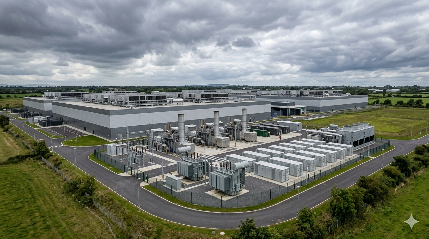
A gigawatt-scale campus requires land to work as an integrated system. The site must accommodate buildings, electrical infrastructure, cooling equipment, roads, drainage, security boundaries, network routes, maintenance access, construction staging, and future development without forcing each new phase into a separate planning problem. Contiguity matters because every break between holdings can introduce another owner, another access agreement, another land-use condition, or another physical constraint that reduces design flexibility. The value of a large site therefore comes from what its continuous geometry enables rather than from its area alone. This changes the way land teams need to screen potential locations because a seemingly inexpensive site can become strategically weak if its boundaries prevent orderly expansion.
Land banking changes the timing of infrastructure development. Instead of acquiring land only after power, network, and customer requirements become immediate, an operator can secure a strategic site while the surrounding geography still offers flexibility. That approach protects against a later land assembly problem in which adjacent owners recognize the site’s strategic importance and become unwilling to sell or impose conditions that make expansion difficult. The early holder gains more than physical control because the surrounding development pattern has not yet fully formed. A future campus can therefore influence where roads, industrial uses, utility corridors, and neighboring development eventually emerge.
The Strategic Value of Holding Future Ground
The logic becomes stronger when the initial site sits within a wider area capable of supporting future industrial clustering. A developer may not need every adjoining property immediately, yet knowing that the surrounding land can accommodate future phases changes the risk profile of the original acquisition. It creates room for electrical infrastructure, water arrangements, access improvements, network extensions, and other supporting requirements that might otherwise compete for space inside the original boundary. Land banking can also prevent competing development from occupying strategically important corridors before the AI project reaches construction. The resulting advantage comes from preserving choices rather than from immediately maximizing the amount of developed land.
This strategy also changes who can participate in future development. Once a region becomes recognized as an emerging AI location, land that previously carried agricultural, industrial, or speculative value can attract new buyers with very different requirements. An early land position can provide greater control over access routes, neighboring uses, and expansion paths before those interests become fragmented. That control matters because the most difficult part of a large campus may not involve the land inside the original site boundary, but the surrounding land needed to make the campus operate efficiently over time.Land banking is increasingly being used as a way to preserve development options before power, permitting and infrastructure conditions tighten further.
From Real Estate Purchase To Long-Term Site Control
The strongest land strategies treat ownership, options, easements, rights of way, and neighboring relationships as parts of one site-control architecture. A developer may secure the principal site while separately protecting access corridors or future utility routes through contractual arrangements that preserve expansion flexibility. Such arrangements can matter even when the associated land never becomes part of the final campus footprint. Their value comes from preventing an external property from blocking a road, network route, drainage pathway, or infrastructure connection that the project may require later. Site control consequently becomes broader than the legal boundary shown on a conventional property map.
Tax structures add another layer because the economic attractiveness of land depends on how the surrounding jurisdiction treats development, equipment, property, infrastructure, and industrial investment. A site with favorable land economics can lose that advantage if its eventual tax treatment creates uncertainty around long-term operating costs or if local authorities alter development conditions as the project expands. Conversely, a jurisdiction may view large-scale development as a catalyst for industrial growth and design a planning environment that encourages coordinated investment. The relevant issue for site selection is therefore not simply whether taxes are low, but whether the fiscal structure remains compatible with the physical development strategy.
The Fiber Corridor Decides The Site
Power can make a site technically viable, but network geography determines whether that site can support the latency, redundancy, and traffic patterns expected from large AI workloads. Traditional data center markets gained an advantage because they combined established fiber routes with carrier ecosystems, cloud connectivity, enterprise demand, and infrastructure that had accumulated over time. That advantage does not disappear when development moves outward, but the value of land changes sharply when a site sits close to multiple independent long-haul routes rather than relying on a single corridor. A remote site with strong network geography can therefore compete with a more expensive urban location when connectivity can reach the campus through resilient routes without forcing the operator to rebuild the surrounding communications architecture.
The change also affects how developers evaluate apparently similar locations outside established hubs. A site beside a major highway may appear strategically positioned because transport access simplifies construction, equipment delivery, and workforce movement, yet that advantage does not compensate for weak communications connectivity when the campus depends on multiple external networks. Fiber routes can follow transportation corridors, utility rights of way, rail alignments, and established metropolitan approaches, creating narrow bands where land has greater strategic value than neighboring sites that appear geographically close. The most useful network assessment therefore needs to examine route diversity, entry points, physical separation, available conduit, future expansion paths, and the ability to reach several network ecosystems without crossing the same vulnerable corridor repeatedly.
The Best Corridor Is The One That Can Expand
Network planning becomes more important when a campus is designed for successive development rather than a single construction phase. AI infrastructure can require additional connectivity as computing clusters expand, storage architectures change, interconnection requirements increase, and workloads move between locations, so a site needs more than an existing fiber connection that satisfies the first building. The underlying land strategy must preserve room for additional conduits, separate entry routes, network rooms, utility crossings, and future connections without forcing later construction through already occupied areas. This favors sites where rights of way can support expansion and where surrounding land uses do not create immediate barriers to extending communications infrastructure.
The implication reaches beyond fiber itself because network corridors influence the industrial geography that forms around them. Once a region develops reliable communications routes, new sites can become attractive even when they lack the legacy concentration of a traditional data center market, provided developers can combine connectivity with power, water, suitable zoning, and expansion capacity. That combination explains why secondary and tertiary markets increasingly appear in development strategies when established hubs face constraints on available land, power delivery, or planning certainty. The strongest locations will not necessarily sit at the geographic center of an existing cluster, because the relevant advantage can instead come from occupying a position where several infrastructure systems intersect without excessive dependence on one corridor. Land acquisition therefore needs to evaluate the future network map rather than simply document the network map that exists when the transaction closes.
Water Rights Are Worth More Than Water Access
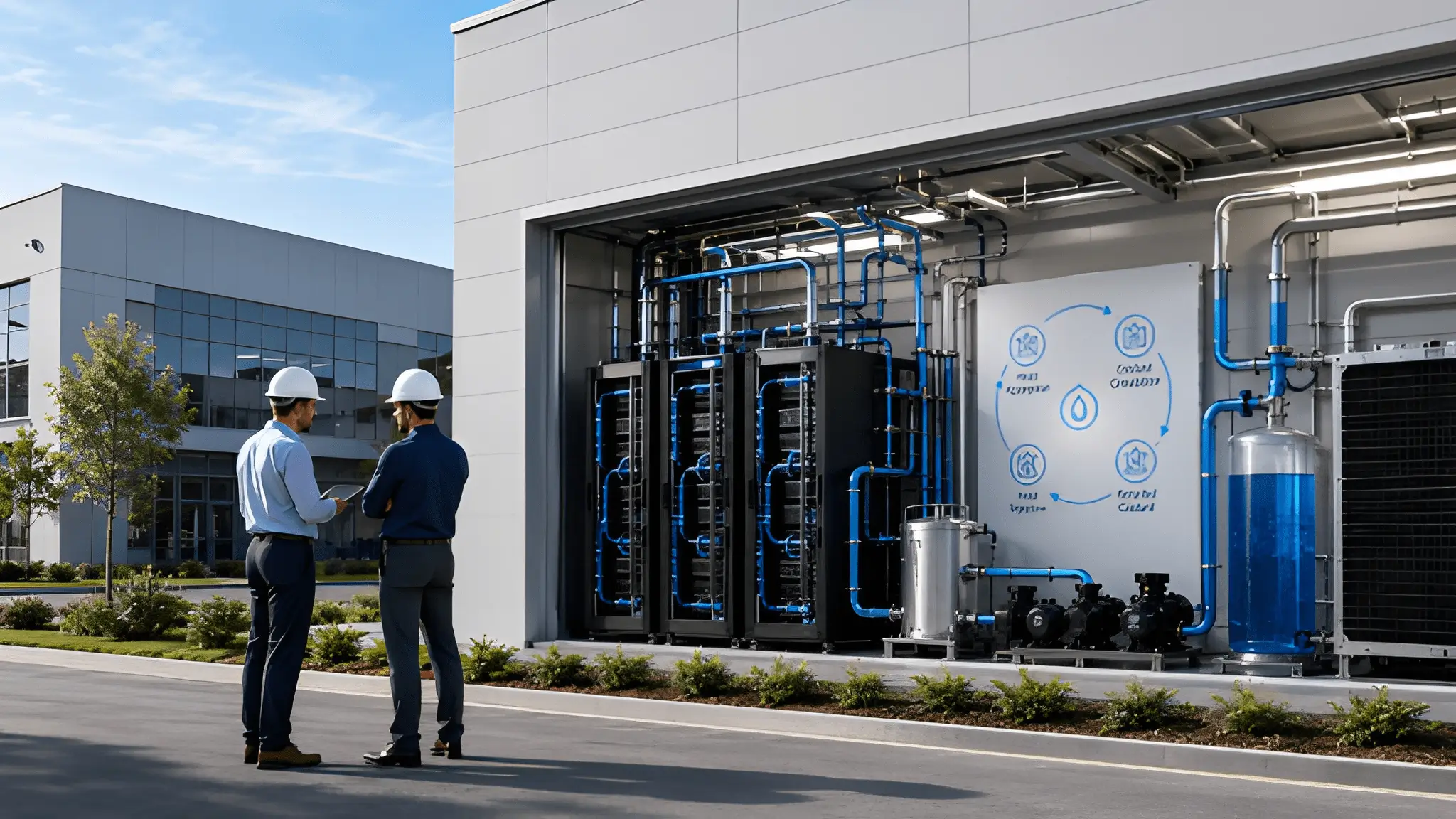
Water has traditionally entered site selection as a utility question, but AI infrastructure increasingly makes the underlying legal and physical security of supply part of land valuation. A site can sit near a municipal network and still face uncertainty if future demand competes with residential requirements, industrial users, drought restrictions, groundwater limits, or changing allocation rules. The more useful question asks whether the water arrangement can remain reliable throughout the operating life of the campus and whether the supply can support the cooling architecture without creating an avoidable conflict with local priorities. In water-constrained regions, those attributes can separate two sites that otherwise look similar from an electrical, transportation, and real-estate perspective. The land itself may therefore become less valuable than the water position attached to it, particularly when a competing site would need to negotiate new access after acquisition rather than inherit an established and legally durable supply arrangement.
Desert markets make this issue especially visible because water policy often distinguishes between potable supplies, groundwater, reclaimed water, recharge arrangements, and other legally recognized sources. Reclaimed water can support nonpotable applications and reduce dependence on drinking-water supplies, but its usefulness depends on treatment quality, permitting, physical delivery, end use, and the infrastructure available between the treatment source and the campus. Arizona’s current regulatory work shows that recycled-water rules continue to evolve as the state expands beneficial reuse and considers how treated wastewater can support additional applications. That means a developer cannot treat proximity to a wastewater system as equivalent to having an immediately usable cooling-water supply. Water diligence consequently becomes a land-selection exercise because the most attractive site may be the one that already sits inside a workable water system rather than the one that merely appears closest to abundant water on a regional map.
Treated Wastewater Can Change The Land Equation
Treated wastewater creates another layer of value because it can connect a data center campus to an existing circular water system rather than forcing the project to compete directly for potable supplies. Where regulations permit industrial reuse, access to treated wastewater can become a meaningful site-selection advantage when the treatment process, delivery infrastructure, permitting pathway, and long-term availability align with the intended cooling architecture. That advantage becomes stronger when neighboring sites lack the physical infrastructure needed to receive reclaimed water, because constructing a new connection can require additional rights of way, approvals, treatment capacity, and coordination with local water systems. Developers therefore need to examine wastewater infrastructure at the same time as they examine electrical substations and fiber routes, rather than treating it as a later environmental or engineering question.
India presents a related challenge because large technology developments can sit within regions where water demand already competes with residential, industrial, agricultural, and environmental requirements. The availability of treated wastewater can therefore become more relevant than simple proximity to a conventional municipal supply, particularly when projects seek to reduce dependence on freshwater sources and align cooling operations with local reuse systems. Yet the same principle applies: a treatment plant nearby does not automatically create an operational water source because capacity, quality, conveyance, permissions, contractual arrangements, and local policy still determine whether the supply can serve a particular site. As AI infrastructure expands outside established metropolitan markets, the ability to secure that water pathway before land acquisition closes can increasingly determine which sites remain viable after technical and community review begins.
Community Consent Is A Land Filter Now
A technically suitable site can fail long before construction if surrounding communities view the proposed land use as incompatible with the character, planning objectives, or future direction of the area. That risk has become more important as large AI infrastructure projects increasingly require zoning decisions, special approvals, environmental reviews, traffic assessments, noise analysis, and consideration of nearby land uses before development can proceed. Community concerns can center on persistent equipment noise, visual scale, construction activity, water demand, changes to agricultural land, pressure on local infrastructure, or the perception that industrial development has moved too close to homes and schools. These concerns do not automatically prevent development, but they can alter the approval pathway, introduce additional conditions, extend negotiations, or make a site less attractive than another location where the surrounding land-use pattern already supports industrial development.
Community consent therefore needs to enter the land-screening process before an acquisition team treats a site as development-ready. A developer can examine zoning maps, utility corridors, environmental conditions, and access roads yet still miss the social geography that determines whether local decision-makers and residents will accept a major industrial project. The most useful assessment considers neighboring uses, previous planning disputes, local development priorities, political sensitivity around industrial growth, and whether the proposed campus fits the community’s established land-use direction. Early engagement can also expose conflicts that technical diligence cannot reveal, such as concerns about noise at particular times, pressure on local water resources, changes to rural landscapes, or opposition to converting land that residents regard as strategically important for agriculture or conservation.
Consent Changes The Meaning Of Development Certainty
Development certainty increasingly depends on whether the surrounding land-use relationship can remain stable throughout the approval and construction process. A site surrounded by compatible industrial uses may face fewer conflicts than a similarly attractive location positioned beside residential neighborhoods, schools, agricultural land, or environmentally sensitive areas, even when both sites have comparable access to infrastructure. That relationship matters because local governments can use comprehensive plans, zoning rules, approval conditions, and site assessments to evaluate whether a proposed development fits the intended future of the area. Recent evidence from Virginia shows that local planning responses have evolved as communities have raised concerns about data center development near residential areas, with zoning changes and additional planning considerations emerging in response.
Community consent does not mean every resident must support a project, nor does it remove legitimate disagreement from the development process. Instead, it means that the probability of sustained local acceptance becomes a factor in comparing otherwise viable sites, particularly when the proposed land use introduces a large industrial presence into an area that has not historically accommodated it. Developers can improve that probability by studying local plans before acquiring land, understanding the concerns most likely to shape public review, preserving appropriate separation from sensitive uses, and designing the campus around the surrounding land pattern rather than treating the boundary as an isolated development envelope.
The Hidden Yield Of The Land Itself
The purchase price of land reveals very little about how efficiently a large AI campus can actually use that land. Topography determines how much grading a project requires, how stormwater moves across the site, where buildings can sit, how roads connect different development areas, and how easily future structures can follow the original campus geometry. Soil conditions matter just as much because foundations, heavy equipment areas, underground utilities, drainage systems, retaining structures, and electrical infrastructure all depend on the physical behavior of the ground beneath them. A site that appears inexpensive can lose that advantage when difficult ground conditions require extensive preparation, complicated drainage solutions, or a more fragmented construction layout than planners originally expected.
Expansion Shape Can Matter More Than Land Area
The geometry of a site can become equally important once an AI campus needs to expand in coordinated phases. A long, narrow site may contain substantial usable land yet make it difficult to position buildings, electrical systems, cooling infrastructure, roads, security boundaries, and utility corridors without creating inefficient connections between operating areas. A more compact site can sometimes provide a better development pattern because the campus can preserve logical separation between construction zones while keeping shared infrastructure within practical reach of multiple buildings. The shape of adjoining land also matters because future expansion depends on whether additional development can extend naturally from the original campus rather than forcing new infrastructure across roads, waterways, incompatible land uses, or separate ownership boundaries. Land diligence therefore needs to examine the development envelope rather than simply comparing the total area available for purchase.
A strong land strategy also considers what happens outside the immediate development boundary because neighboring land can determine whether the campus retains strategic flexibility. Surrounding industrial zoning may protect future expansion routes, while fragmented ownership, residential growth, conservation restrictions, agricultural preservation policies, or incompatible development can effectively turn otherwise available land into unusable space. This is why large-scale site selection increasingly requires a broader view of the land system surrounding the proposed campus, including access corridors, utility approaches, drainage patterns, network routes, and the likely direction of local development. A site that leaves room for future growth without creating conflicts can carry greater strategic value than a larger site whose physical configuration forces every additional phase into a separate engineering problem.
What A Gigawatt Campus Does To The Land Around It
A large AI campus does not remain an isolated real-estate transaction once construction begins because its infrastructure requirements can change how surrounding land is perceived, valued, and planned. New substations, transmission routes, fiber corridors, roads, water infrastructure, and industrial zoning can make nearby sites more attractive for activities that depend on reliable infrastructure without requiring those sites to host another data center. Agricultural land near a proposed development can therefore attract speculative interest when owners anticipate future industrial conversion, while neighboring industrial sites may gain strategic value because they can connect more easily to infrastructure being developed for the primary campus. The opposite can also occur when noise, water pressure, traffic, visual impact, or incompatible land use makes surrounding property less desirable for existing residents or businesses.
The arrival of a major campus can also encourage industrial clustering because supporting activities often value proximity to reliable power, communications infrastructure, transportation links, and an established development environment. Landowners may begin positioning nearby sites for warehouses, equipment services, manufacturing, logistics, utilities, or other activities that can operate within the emerging industrial ecosystem. That process can reinforce the original location decision because every additional infrastructure investment makes the surrounding area more capable of supporting related development. Yet clustering does not automatically create positive outcomes because communities may also experience pressure on roads, utilities, water resources, housing, agricultural land, and local planning capacity.
Speculative Holding Changes The Development Map
Speculative land holding can become another consequence when owners believe infrastructure investment will eventually make surrounding land more valuable for industrial development. That expectation can slow transactions because landowners may prefer to wait for clearer evidence of future development rather than sell before the market reprices the area. Developers then face a more complicated acquisition environment because the availability of neighboring land may change even when the primary campus has already secured its own development footprint. Early land banking can therefore become defensive as well as strategic, allowing an operator to preserve expansion options before surrounding owners understand how infrastructure investment could change local land values. This dynamic can also encourage governments to examine broader land-use plans because infrastructure decisions made for one project can influence development pressure across a much larger area.
The same process is visible in emerging markets where governments use industrial land policy, infrastructure preparation, tax treatment, and development incentives to attract digital infrastructure beyond established metropolitan centers. In India, current policy efforts increasingly combine prepared industrial land with infrastructure and incentives, creating development environments intended to reduce the friction associated with assembling and servicing new industrial sites. Such policies can alter land-market behavior because developers are no longer evaluating undeveloped land solely on its acquisition cost; they are evaluating how quickly the surrounding industrial ecosystem can become usable. It also means that the economic effect of an AI campus can extend into surrounding industrial development, provided infrastructure planning and community priorities remain aligned.
The Next Map Won’t Be Drawn In The Usual Places
Successful sites need a coordinated relationship between land availability, electrical infrastructure, fiber diversity, water security, planning certainty, tax treatment, physical conditions, expansion potential, and community acceptance. That combination makes site selection a systems decision in which a weakness in one layer can undermine advantages created by every other layer. Established markets retain important benefits because their infrastructure, connectivity, workforce, regulatory knowledge, and development ecosystems already exist, but those advantages become less decisive when land scarcity or local constraints prevent a campus from expanding in a coherent way. Emerging markets can therefore become competitive when they offer a more complete development environment rather than simply offering cheaper land or greater physical space. Current research increasingly treats data center siting as a multidimensional planning problem involving infrastructure, land use, environmental conditions, and spatial relationships rather than as a straightforward real-estate decision.
The importance of this combination is already visible in emerging development strategies where investors are examining locations beyond established hubs because traditional markets face constraints around land, power availability, planning, or development timing. In India, policy efforts aimed at developing data center capacity outside the most established markets similarly show how land incentives, infrastructure preparation, and regional policy can influence where future capacity becomes economically viable. In the United States, research and public planning discussions increasingly place land use, water, community effects, and infrastructure coordination alongside power when evaluating proposed development. The geographic center of AI infrastructure can therefore change without requiring established hubs to disappear, because new regions can capture incremental development when their combined land strategy offers fewer constraints.
The First-Mover Advantage Will Come From Land Strategy
The most consequential land decisions will increasingly happen before a project becomes visible as a construction proposal. Operators that identify suitable regions early can study surrounding ownership, water arrangements, fiber corridors, zoning trajectories, tax structures, environmental constraints, and community sentiment before competing projects alter the development landscape. That preparation allows land strategy to move from a transactional exercise into a form of infrastructure planning, where the objective is to preserve multiple paths toward development rather than commit immediately to a single site. It also creates a stronger basis for rejecting sites that look attractive on paper but depend on unresolved water access, difficult approvals, weak network diversity, incompatible surrounding land uses, or uncertain expansion routes. Early diligence cannot eliminate every development risk, but it can prevent land acquisition from becoming the starting point for problems that should have been identified before the transaction.
That strategy ultimately changes how the AI infrastructure map should be read. Major metropolitan markets will remain important because existing connectivity, skilled labor, established infrastructure, and customer ecosystems still carry substantial value, but proximity to a familiar market will no longer answer the full site-selection question for every large development. The strongest emerging locations will be those where land, power, fiber, water, taxation, physical conditions, planning, and community expectations can align without forcing the developer to solve each constraint independently after acquisition. This creates a more distributed development landscape in which regional planning quality can matter as much as metropolitan prestige, particularly when governments and landowners prepare infrastructure and approvals before demand arrives. The land strategy behind an AI campus can consequently shape not only the project’s economics but also the industrial geography that forms around it, making site selection a long-term regional decision rather than a narrow real-estate exercise.